It looks like you're offline.
Open Library logo
additional options menu
Last edited by MARC Bot
December 16, 2022 | History

Library of Congress. Geography and Map Division.

We need a photo of Library of Congress. Geography and Map Division.

13 works Add another?

Showing all works by author. Would you like to see only ebooks?

  • Cover of: bibliography of cartography.

    My Reading Lists:

    Create a new list

    Check-In

    ×Close
    Add an optional check-in date. Check-in dates are used to track yearly reading goals.
    Today
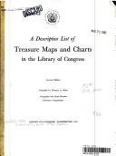
  • Cover of: A descriptive list of treasure maps and charts in the Library of Congress.

    My Reading Lists:

    Create a new list

    Check-In

    ×Close
    Add an optional check-in date. Check-in dates are used to track yearly reading goals.
    Today
  • Cover of: Civil War maps: an annotated list of maps and atlases in the Library of Congress

    My Reading Lists:

    Create a new list

    Check-In

    ×Close
    Add an optional check-in date. Check-in dates are used to track yearly reading goals.
    Today
  • Cover of: Geographic cutters

    My Reading Lists:

    Create a new list

    Check-In

    ×Close
    Add an optional check-in date. Check-in dates are used to track yearly reading goals.
    Today
  • Cover of: Land Ownership maps: a cheklist of nineteenth century United States County mapsin the Library of Congress

    My Reading Lists:

    Create a new list

    Check-In

    ×Close
    Add an optional check-in date. Check-in dates are used to track yearly reading goals.
    Today
  • Cover of: Library of Congress geography and maps: an illustrated guide

    My Reading Lists:

    Create a new list

    Check-In

    ×Close
    Add an optional check-in date. Check-in dates are used to track yearly reading goals.
    Today
  • Cover of: Map cataloging manual

    My Reading Lists:

    Create a new list

    Check-In

    ×Close
    Add an optional check-in date. Check-in dates are used to track yearly reading goals.
    Today
  • Cover of: Panoramic maps of Anglo-American cities: a checklist of maps in the collections of the Library of Congress, Geography and Map Division.

    My Reading Lists:

    Create a new list

    Check-In

    ×Close
    Add an optional check-in date. Check-in dates are used to track yearly reading goals.
    Today
  • Cover of: Panoramic maps of cities in the United States and Canada: a checklist of maps in the collections of the Library of Congress, Geography and Map Division

    My Reading Lists:

    Create a new list

    Check-In

    ×Close
    Add an optional check-in date. Check-in dates are used to track yearly reading goals.
    Today
  • Cover of: The Geography and Map Division: a guide to its collections and services.

    My Reading Lists:

    Create a new list

    Check-In

    ×Close
    Add an optional check-in date. Check-in dates are used to track yearly reading goals.
    Today
  • Cover of: Ward maps of United States cities: a selective checklist of pre-1900 maps in the Library of Congress

    My Reading Lists:

    Create a new list

    Check-In

    ×Close
    Add an optional check-in date. Check-in dates are used to track yearly reading goals.
    Today
  • Cover of: Land ownership maps, a checklist: of nineteenth century United States county maps in the Library of Congress.

    My Reading Lists:

    Create a new list

    Check-In

    ×Close
    Add an optional check-in date. Check-in dates are used to track yearly reading goals.
    Today
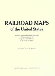
  • Cover of: Railroad maps of the United States: a selective annotated bibliography of original 19th-century maps in the Geography and Map Division of the Library of Congress

    My Reading Lists:

    Create a new list

    Check-In

    ×Close
    Add an optional check-in date. Check-in dates are used to track yearly reading goals.
    Today

History

Download catalog record: RDF / JSON
December 16, 2022 Edited by MARC Bot add entity_type=org and remote_ids
April 1, 2008 Created by an anonymous user initial import