Check nearby libraries
Buy this book

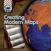
Discusses the improvements made to navigational instruments and printing techniques since the Age of Exploration.
Publish Date
January 2008
Publisher
Checkerboard Books,
ABDO Publishing Company
Language
English
Pages
32
Check nearby libraries
Buy this book

Previews available in: English
| Edition | Availability |
|---|---|
| 1 |
zzzz
|
|
2
Creating Modern Maps
January 2008, Checkerboard Books, ABDO Publishing Company
Library Binding
in English
1599289490 9781599289496
|
aaaa
|
Book Details
Table of Contents
Early mapmaking.
New mapping tools.
America's first maps.
Defining America.
Printing techniques.
On the move.
A new view.
GIS technology.
Glossary.
Web sites.
Index.
Edition Notes
Includes bibliographical references and index.
Classifications
The Physical Object
Edition Identifiers
Work Identifiers
Community Reviews (0)
History
- Created April 30, 2008
- 14 revisions
Wikipedia citation
×CloseCopy and paste this code into your Wikipedia page. Need help?
| February 17, 2023 | Edited by ImportBot | import existing book |
| December 9, 2022 | Edited by ImportBot | import existing book |
| December 17, 2020 | Edited by MARC Bot | import existing book |
| March 1, 2020 | Edited by dcapillae | Added desc. and TOC |
| April 30, 2008 | Created by an anonymous user | Imported from amazon.com record |


