Check nearby libraries
Buy this book

Last edited by Camillo Pellizzari
December 14, 2019 | History
This 6 volume work has inspired loving descriptions. The Wikipedia entry[1] is among the best. Google books posts a note in the Bibliographic Society of America's Papers[2] for 1918 which mentions that the 3rd volume has been published.
Check nearby libraries
Buy this book

Previews available in: English
| Edition | Availability |
|---|---|
|
1
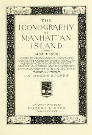
The iconography of Manhattan Island, 1498-1909: compiled from original sources and illustrated by photo-intaglio reproductions of important maps, plans, views, and documents in public and private collections
1998, Martino Fine Books, Lawbook Exchange
in English
1886363307 9781886363304
|
zzzz
|
| 2 |
zzzz
|
| 3 |
aaaa
|
| 4 |
bbbb
|
| 5 |
bbbb
|
| 6 |
bbbb
|
Book Details
Table of Contents
v. 1. The period of discovery (1524-1609); the Dutch period (1609-1664). The English period (1664-1763). The Revolutionary period (1763-1783). Period of adjustment and reconstruction; New York as the state and federal capital (1783-1811)
v. 2. Cartography: an essay on the development of knowledge regarding the geography of the east coast of North America; Manhattan Island and its environs on early maps and charts / by F.C. Wieder and I.N. Phelps Stokes. The Manatus maps. The Castello plan. The Dutch grants. Early New York newspapers (1725-1811). Plan of Manhattan Island in 1908
v. 3. The War of 1812 (1812-1815). Period of invention, prosperity, and progress (1815-1841). Period of industrial and educational development (1842-1860). The Civil War (1861-1865); period of political and social development (1865-1876). The modern city and island (1876-1909)
v. 4. The period of discovery (565-1626); the Dutch period (1626-1664). The English period (1664-1763). The Revolutionary period, part I (1763-1776)
v. 5. The Revolutionary period, part II (1776-1783). Period of adjustment and reconstruction New York as the state and federal capital (1783-1811). The War of 1812 (1812-1815) ; period of invention, prosperity, and progress (1815-1841). Period of industrial and educational development (1842-1860). The Civil War (1861-1865) ; Period of political and social development (1865-1876). The modern city and island (1876-1909)
v. 6. Chronology: addenda. Original grants and farms. Bibliography. Index.
Edition Notes
Classifications
The Physical Object
ID Numbers
Community Reviews (0)
Feedback?History
- Created July 14, 2009
- 4 revisions
Wikipedia citation
×CloseCopy and paste this code into your Wikipedia page. Need help?
| December 14, 2019 | Edited by Camillo Pellizzari | merge authors |
| April 13, 2010 | Edited by Open Library Bot | Linked existing covers to the edition. |
| December 15, 2009 | Edited by WorkBot | link works |
| July 14, 2009 | Created by ImportBot | Imported from Internet Archive item record |


