Check nearby libraries
Buy this book

This edition doesn't have a description yet. Can you add one?
Check nearby libraries
Buy this book

| Edition | Availability |
|---|---|
|
1
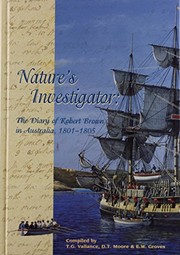
Nature's investigator: the diary of Robert Brown in Australia, 1801-1805
2001, Australian Biological Resources Study (Flora)
in English
0642568170 9780642568175
|
aaaa
|
Book Details
Table of Contents
Machine generated contents note: The beginning of biological exploration
British settlement in Australia
A summary of Robert Brown's collecting localities
Brown's wider interests
Sources
The expedition's natural history collections
The artwork of the voyage
Conclusion
Chapter 1. Preparations for the voyage
Chapter 2. The voyage begins
Chapter 3. Interlude at the Cape of Good Hope
and from there to Australia
Chapter 4. Brown in south-western Australia
Chapter 5. The Great Australian Bight
Chapter 6. The Spencer Gulf area
Chapter 7. Kangaroo Island and the French encounter
Chapter 8. Bass Strait, Port Phillip, King Island and Sydney
Chapter 9. Sydney and neighbourhood, May-June 1802
Chapter 10. Circumnavigation of the continent begins
Chapter 11. Events at Broad Sound
Chapter 12. Great Barrier Reef and Torres Strait
Chapter 13. The Gulf of Carpentaria
Chapter 14. The Sir Edward Pellew Group to Groote Eylandt
and Blue Mud Bay
Chapter 15. Blue Mud Bay to Bremer Island
Chapter 16. The North Coast
Chapter 17. The stay at Timor and return to Sydney
Chapter 18. Sydney and neighbourhood, June-November 1803
Chapter 19. Flinders' troubles begin
Chapter 20. The voyage to Tasmania, Port Dalrymple
and Port Phillip
Chapter 21. Derwent River, February-April 1804
Chapter 22. Derwent River, May-August 1804
Chapter 23. Back at Sydney, late 1804
Chapter 24. Visit to the Hunter River, October-November 1804
Chapter 25. Grose River area, December 1804-January 1805
Chapter 26. Last days at Sydney
Chapter 27. The return voyage and homecoming
References
Index
TEXT FIGURES
Figure 1. Engraving of Glossopteris browniana leaves
Figure 2. Brown's Diary for Monday 7 December 1801,
recording the first Australian landfall
Figure 3. Brown's Diary for 14 March 1804, on Table Mountain,
Tasmania
MAPS
Map 1. The King George Sound area of Western Australia.
Map 2. Lucky Bay and part of the Archipelago of the
Recherche, Western Australia
Map 3. Goose Island Bay, Middle Island, Archipelago of
the Recherche, Western Australia
Map 4. The Fowlers Bay area of South Australia
Map 5. The St Francis Island, Smoky Bay and Goat Island
area of South Australia
Map 6. Flinders and Waldegrave Islands, South Australia
Map 7. The Memory Cove and Port Lincoln areas of South
Australia
Map 8. The Sir Joseph Banks Group of islands, South
Australia
Map 9. The approximate route taken by Brown and party to
Mt Brown, South Australia
Map 10. Part of the north coast of Kangaroo Island, South
Australia
Map 11. Head of Gulf St Vincent, South Australia
Map 12. The northern end of King Island, Tasmania
Map 13. Port Phillip Bay, Victoria
Map 14. The Sydney district, New South Wales.
Edition Notes
Commonwealth of Australia 2001.
Includes bibliographical references (p. 609-622).
Includes index.
Classifications
External Links
The Physical Object
ID Numbers
Community Reviews (0)
History
- Created April 1, 2008
- 8 revisions
Wikipedia citation
×CloseCopy and paste this code into your Wikipedia page. Need help?
| December 6, 2020 | Edited by MARC Bot | import existing book |
| October 8, 2020 | Edited by ImportBot | import existing book |
| July 31, 2020 | Edited by ImportBot | import existing book |
| March 28, 2019 | Edited by ImportBot | import existing book |
| April 1, 2008 | Created by an anonymous user | Imported from Scriblio MARC record |


