Check nearby libraries
Buy this book

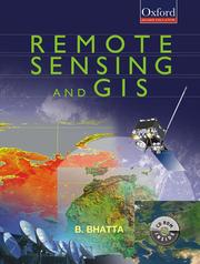
Beginning with the history and basic concepts of remote sensing and GIS, the book gives an exhaustive coverage of optical, thermal and microwave remote sensing, global navigation satellite systems (such as GPS), digital photogrammetry, visual image analysis, digital image processing, spatial and attribute data model, geospatial analysis, and planning, implementation and management of GIS
Remote Sensing and GIS is specifically designed to serve as a basic text for undergraduate courses in civil engineering, geoinformatics/geomatics engineering, geotechnical engineering, survey engineering, and environmental engineering. It will equally meet the requirements of undergraduate courses in geological science, environmental science, geography, geophysics, earth resources management, environmental management, and disaster management. The book provides a thorough understanding of the basic principles and techniques of remote sensing, geographic information systems (GIS), and their applications. It also presents the modern trends of remote sensing and GIS with an illustrated discussion on its numerous applications. The appendices provide the prerequisites required for understanding remote sensing and GIS technology. Owing to its lucid style and presentation of advanced topics, the book will also be useful to postgraduate students as well as practising professionals from the geomatics community.
Check nearby libraries
Buy this book

Subjects
Remote sensing, Geographic information systemsShowing 2 featured editions. View all 2 editions?
| Edition | Availability |
|---|---|
|
1
Remote Sensing and GIS
2020, Oxford University Press India, Oxford
in English
0199496641 9780199496648
|
zzzz
Libraries near you:
WorldCat
|
| 2 |
aaaa
Libraries near you:
WorldCat
|
Book Details
Edition Notes
Classifications
The Physical Object
ID Numbers
Community Reviews (0)
Feedback?| August 2, 2020 | Edited by ImportBot | import existing book |
| April 28, 2010 | Edited by Open Library Bot | Linked existing covers to the work. |
| January 29, 2010 | Edited by WorkBot | add more information to works |
| December 11, 2009 | Created by WorkBot | add works page |


