Buy this book

This edition doesn't have a description yet. Can you add one?
Buy this book

Previews available in: English
Subjects
Geodesy, Arc measures, Triangulation, Isostasy, United States, Figure, Gravity, Longitude, Map projection, Surveying, Zenith Telescope, Latitude variation, Least squaresPlaces
United States, Earth, Georgia, MaineShowing 10 featured editions. View all 30 editions?
| Edition | Availability |
|---|---|
| 01 |
bbbb
|
|
02
Geodesy: tables for a polyconic projection of maps, based upon Clarke's reference spheroid of 1866.
1917, Govt. Print Off.
- 4th ed.
|
bbbb
|
|
03
Geodesy: triangulation along the Columbia River and the coasts of Oregon and northern California
1915, Govt. Print. Off.
|
bbbb
|
|
04
Geodesy.: Triangulation in West Virginia, Ohio, Kentucky, Indiana, Illinois, and Missouri
1915, Govt. Print. Off.
|
bbbb
|
| 05 |
bbbb
|
|
06
Geodesy: triangulation on the coast of Texas, from Sabine Pass to Corpus Christi Bay
1913, Govt. Print. Off.
|
bbbb
|
| 07 |
bbbb
|
|
08
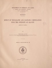
Geodesy.: Effect of topography and isostatic compensation upon the intensity of gravity. (Second paper)
1912, Govt. print. off.
in English
|
aaaa
|
| 09 |
bbbb
|
| 10 |
bbbb
|
Book Details
Edition Notes
At head of title: Department of commerce and labor. Coast and geodetic survey. O.H. Tittmann, superintendent.
Classifications
The Physical Object
ID Numbers
Community Reviews (0)
Feedback?| August 13, 2020 | Edited by MARC Bot | remove fake subjects |
| November 23, 2012 | Edited by Anand Chitipothu | Reverted spam |
| November 21, 2012 | Edited by 188.190.125.67 | Edited without comment. |
| December 17, 2011 | Edited by ImportBot | import new book |
| December 9, 2009 | Created by WorkBot | add works page |


