Check nearby libraries
Buy this book

This work doesn't have a description yet. Can you add one?
Check nearby libraries
Buy this book

Previews available in: English
| Edition | Availability |
|---|---|
|
1
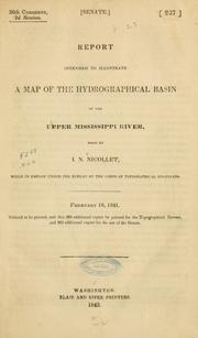
Report intended to illustrate a map of the hydrographical basin of the upper Mississippi river
1845, Blair and Rives, printers
in English
|
zzzz
|
|
2
Report intended to illustrate a map of the hydrographical basin of the upper Mississippi river
1843, Blair and Rives, printers
in English
|
aaaa
|
Book Details
Table of Contents
Pt. I. Physical geography of the region embraced within the map
Sketch of the early history of St. Louis
Pt. II.
App. A. Table of geographical positions
App. B. Catalogue of plants collected by Mr. Charles Geyer ... during his exploration of the region between the Mississippi and Missouri rivers / by John Torrey
App. C. List of fossils belonging to the several formations alluded to in the report, arranged according to localities.
Edition Notes
"February 16, 1841. Ordered to be printed, and that 200 additional copies be printed for the Topographical Bureau, and 300 additional copies for the use of the Senate."
Graff Coll. 3022
Sabin 55257
Wagner-Camp-Becker 98
Buck, S.J. Travel, 339
Classifications
The Physical Object
Edition Identifiers
Work Identifiers
Community Reviews (0)
| July 14, 2020 | Edited by MARC Bot | remove fake subjects |
| May 11, 2010 | Edited by EdwardBot | add Accessible book tag |
| April 28, 2010 | Edited by Open Library Bot | Linked existing covers to the work. |
| January 31, 2010 | Edited by WorkBot | add more information to works |
| December 9, 2009 | Created by WorkBot | add works page |


