Check nearby libraries
Buy this book

This edition doesn't have a description yet. Can you add one?
Publish Date
1899
Language
English
Check nearby libraries
Buy this book

Previews available in: English
Subjects
Maps, Real property, Farms, LandownersPlaces
Larue County (Ky.), Kentucky, Larue CountyShowing 1 featured edition. View all 1 editions?
| Edition | Availability |
|---|---|
| 1 |
aaaa
Libraries near you:
WorldCat
|
Book Details
Edition Notes
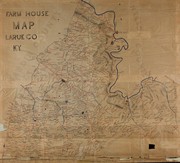
Shows the names of some residents.
Relief shown by hachures.
"Rand McNally & Co. Engravers, Chicago."
Annotations in red and blue ink, mounted on cloth backing.
LC Land ownership maps, 235
Classifications
The Physical Object
ID Numbers
Community Reviews (0)
Feedback?| September 21, 2016 | Created by ImportBot | import new book |


