Check nearby libraries
Buy this book

This edition doesn't have a description yet. Can you add one?
Check nearby libraries
Buy this book

Previews available in: English
Subjects
Early maps, Directories, Map collections, Cartes, Bibliographie, Catalogues, Ouvrages avant 1800, Répertoires, History, Handbooks, manuals, Maps, Archives and libraries, Inventories, registers, catalogs, Adressbuch, Besitzer, Bibliografie, Geschichte, Historische Karte, Karte, Kartografie, Kaartenverzamelingen, Cartography, Catalogs, Sammlung, Bauhaus Dessau Bereich Architektur und Sammlungen, Bauhaus DessauPlaces
Great Britain, IrelandShowing 2 featured editions. View all 2 editions?
| Edition | Availability |
|---|---|
|
1
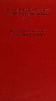
Historians' Guide to Early British Maps: A Guide to the Location of Pre-1900 Maps of the British Isles Preserved in the United Kingdom and Ireland (Guides and Handbooks, No. 18.)
December 1994, Royal Historical Society
Hardcover
in English
0861931416 9780861931415
|
aaaa
Libraries near you:
WorldCat
|
|
2
Historians' guide to early British maps: a guide to the location of pre-1900 maps of the British Isles preserved in the United Kingdom and Ireland
1994, Offices of the Royal Historical Society
in English
0861931416 9780861931415
|
zzzz
Libraries near you:
WorldCat
|
Book Details
Classifications
The Physical Object
ID Numbers
Community Reviews (0)
Feedback?| July 9, 2021 | Edited by ImportBot | import existing book |
| February 7, 2019 | Created by MARC Bot | import existing book |


