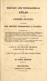
A military and topographical atlas of the United States

including the British possessions & Florida: comprehending 1. Map and description of the seat of war in North America, including the British possessions, accompanied with small maps of the Straits of Niagara, of the east end of Lake Ontario, and a map and plan of Montreal. 2. Map and description of the southern section of the United States, including Florida, &c. 3. Map of the American coast, from Lynhaven Bay to Narraganset Bay. 4. Map of Detroit River and adjacent country. 5. Map of Quebec and adjacent country; with the official documents relative to the operations of the British Army in reducing the Canadas. To which is added, a list of the military districts, a register of the army, and a list of the navy of the United States.

  • 0 Ratings
  • 0 Want to read
  • 0 Currently reading
  • 0 Have read

My Reading Lists:

Create a new list

Check-In

×Close
Add an optional check-in date. Check-in dates are used to track yearly reading goals.
Today

  • 0 Ratings
  • 0 Want to read
  • 0 Currently reading
  • 0 Have read


Download Options

Buy this book

Last edited by ImportBot
August 7, 2012 | History

A military and topographical atlas of the United States

including the British possessions & Florida: comprehending 1. Map and description of the seat of war in North America, including the British possessions, accompanied with small maps of the Straits of Niagara, of the east end of Lake Ontario, and a map and plan of Montreal. 2. Map and description of the southern section of the United States, including Florida, &c. 3. Map of the American coast, from Lynhaven Bay to Narraganset Bay. 4. Map of Detroit River and adjacent country. 5. Map of Quebec and adjacent country; with the official documents relative to the operations of the British Army in reducing the Canadas. To which is added, a list of the military districts, a register of the army, and a list of the navy of the United States.

  • 0 Ratings
  • 0 Want to read
  • 0 Currently reading
  • 0 Have read

An atlas and gazetteer describing parts of North America connected with the American War of 1812, with an appended roster of American commissioned officers in the United States Army as of November 1813.

Publish Date
Language
English
Pages
44

Buy this book

Previews available in: English

Book Details


Edition Notes

Published in
Philadelphia

Classifications

Library of Congress
G1201.S42 M4 1813

The Physical Object

Pagination
6, [3]-34, [3]-18, [3]-29, 44 p.
Number of pages
44

ID Numbers

Open Library
OL23721027M
Internet Archive
militarytopograp00meli
LCCN
04007841
OCLC/WorldCat
4137579

Community Reviews (0)

Feedback?
No community reviews have been submitted for this work.

History

Download catalog record: RDF / JSON
August 7, 2012 Edited by ImportBot import new book
September 18, 2011 Edited by 76.181.70.91 Edited without comment.
December 3, 2010 Edited by Open Library Bot Added subjects from MARC records.
February 4, 2010 Edited by WorkBot add more information to works
December 9, 2009 Created by WorkBot add works page