Check nearby libraries
Buy this book

This work doesn't have a description yet. Can you add one?
Check nearby libraries
Buy this book

Previews available in: English
Book Details
Edition Notes
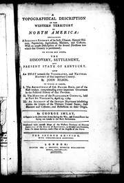
"Illustrated with correct maps of the western territory of North America, of the state of Kentucky ... and a plan of the rapids of the Ohio."
Includes index.
Filmed from a copy of the original publication held by the Metropolitan Toronto Library, History Department. Ottawa : Canadian Institute for Historical Microreproductions, 1986.
xvi, 17 [i.e. 433] p. : maps ; 22 cm.
Classifications
The Physical Object
ID Numbers
Community Reviews (0)
| August 13, 2020 | Edited by MARC Bot | remove fake subjects |
| August 3, 2012 | Edited by ImportBot | import new book |
| November 30, 2010 | Created by ImportBot | initial import |


