Buy this book

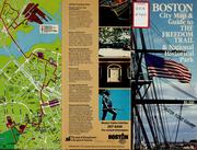
...brief description (with photos) of historic sites along Boston's Freedom Trail; includes map of the Trail and map of downtown Boston and Cambridge showing the location of 211 facilities in the following categories: Hotels and Motels, Major Parking Facilities, Transportation Centers, Exhibition Halls and Auditoriums, Sightseeing Centers, Historic Sites, Mueums and Exhibits, Public Buildings and Places, Performance Centers and Sports Facilities, and Educational and Medical Centers; also includes a map of the rapid transit lines and a map of greater Boston accompanied by a text description of how to get in and out of Boston; this item was in the BRA collection...
Buy this book

Previews available in: English
| Edition | Availability |
|---|---|
| 1 |
aaaa
|
Book Details
The Physical Object
ID Numbers
Community Reviews (0)
Feedback?| July 26, 2011 | Created by ImportBot | import new book |


